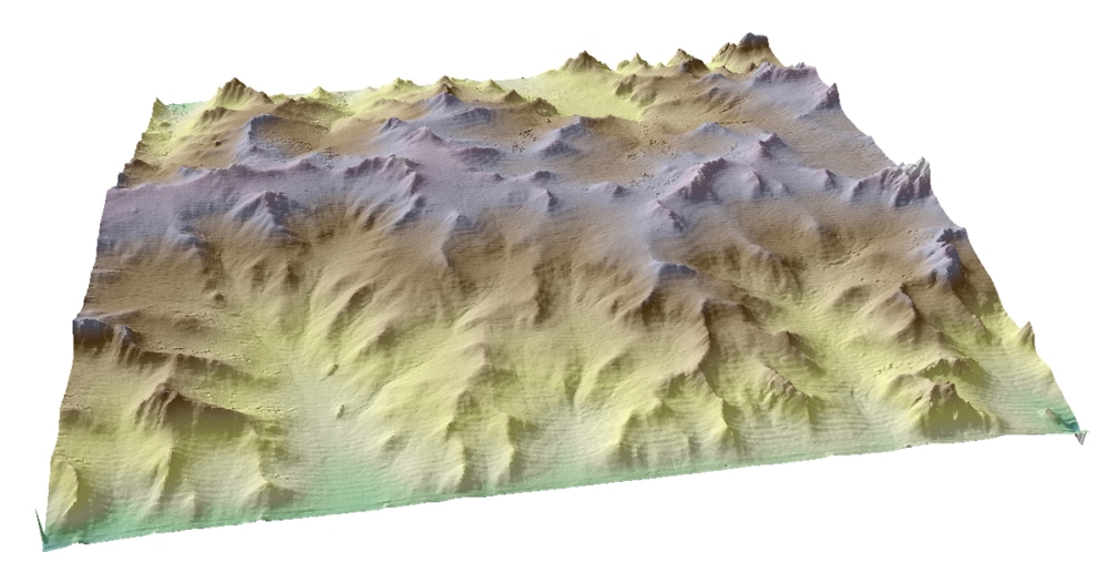
I haven’t done this very often, but I couldn’t resist a short post on a recent study that connects with the title of this blog.
In many areas where water slices into the surface as it searches for sea level, the landscape is defined by hills creased with sharp stream valleys. There may be broad hills separated by a relatively sparse network of valleys, or valleys and gullies may invade almost everywhere, leaving only narrow bits of high ground. Apart from things like rock/sediment type, geomorphologists have surmised that the difference between those two extremes is a pair of competing forces: 1) the evenly distributed downhill motion of hillslope sediment and 2) the focused erosion of flowing streams in the valleys. If hillslope erosion is stronger, broad hills win out. But if river erosion is dominant, a dense network of valleys will carve up those hills.
That idea is a difficult one to test. If you sit yourself down to watch a landscape change, you’re going to be disappointed. Researchers have used computer simulations to explore this relationship, but that’s not the same as seeing it in the geologic flesh. Kristin Sweeney and Joshua Roering at the University of Oregon, and the University of Minnesota’s Christopher Ellis, took a different tack, building a sandbox model to play with the phenomenon in miniature.
The challenge in building physical models is to get all the forces to scale down, and it’s impossible to pull that off in this case. Although they used very fine-grained silica, the particles are still going to be too big, and the raindrops too large, etc. But even if it isn’t a planet-in-a-box, the model served well as a useful stand-in. Water was dropped onto the sediment in one of two ways: through very fine misters and needle-point droplets. The droplets hit the miniaturized surface like huge raindrops, moving sediment on impact. This takes the place of a number of processes that move sediment downslope, like freeze-thaw “creep”, burrowing animals, tree root wedging, and landslides. The gentle mist, on the other hand, collected and rolled into gullies to flow downhill. Two sides of the box dropped gradually, creating an ever-lower outlet for sediment-laden water. This is like the tectonic uplift that maintains a steep gradient and makes for rapid streamflow.
During their experiments, “precipitation” alternated between the mist and the droplets for 10 to 15 hours. The researchers varied the proportion of each experiment that water was descending as a mist and as droplets. More mist gives you more valley erosion, while more droplets gives you more diffuse hillslope erosion. A laser scanner frequently mapped the surface of the model sediment to track the progress of landscape erosion.
In experiments where valley erosion was stronger, the result looked like this:
In the experiments where hillslope erosion dominated, however, the result looked like this:
That backs up the theory explaining valley spacing as a competition between stream and hillslope erosion. Not only does that mean that climate controls this striking characteristic of landscapes, but changes in climate and vegetation should lead to an interesting evolution of that landscape. As the researchers write, “Robust linkages between transport processes and topography, as discussed here, are an important component of interpreting planetary surfaces as well as decoding paleolandscapes and sedimentary deposits.” And that’s how a sandbox can tell you about other worlds, and the past of this one.
Science. DOI:10.1126/science.aab0017